+1 (888) 555-ARCUS info@arcuscad.com
Mon-Fri: 8:00 AM - 6:00 PM EST

Subdivision & Plat Drafting

Final plat preparation for land division and recording formatted to local jurisdiction requirements.

Subdivision & Plat Drafting

FINAL RECORDABLE PLATS & SUBDIVISIONS LAYOUTS

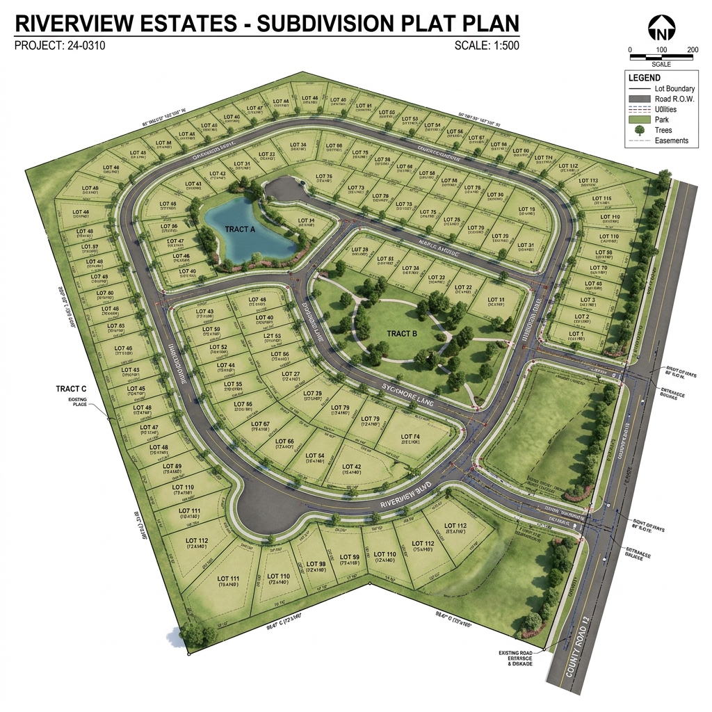
A final subdivision plat is a legal instrument of land division — one that creates the lots, streets, easements, and dedications that will define a development for decades. It must be accurate to the arc second and formatted precisely to the recording jurisdiction's requirements, because any error or non-conformity creates title problems, delays recording, or necessitates costly re-survey. ArcusCAD prepares final plats that are complete, accurate, and formatted to pass first-submission review.

Our templates match state-specific formatting mandates, notary acknowledgments, and certificate requirements to ensure a seamless approval cycle.

Contact Us

OUR SUBDIVISION & PLAT DRAFTING SERVICES

Lot Layout with Curve & DMS Bearing Data
Gross & Net Area Calculations (Sq Ft & Acres)
Street Layout & Public Easement Dedications
Control Monument & Corner Mark Notation
Required Owner & Surveyor Certificates Blocks
Jurisdiction-Specific Page Sizes & Margins Format

Ideal For

PLS firms handling residential and commercial subdivision projects, planned unit developments, rural land divisions, rural residential subdivisions, and condominium plat preparation across any US jurisdiction.

Deliverables & Formats

  • AutoCAD Native: DWG final plat files structured for jurisdiction checks.
  • High-Res PDF: Clear print sets ready for record recording.

Request a Quote

Have a subdivision plat project pending office review? Outsource to ArcusCAD today.

Get a Free Proposal
ArcusCAD Asssitant
Online
Hello! I'm your ArcusCAD assistant. How can I help you stream-line your land surveying drafting workflow today?