Precision Drafting & Design for Engineering and Surveying Firms
ArcusCAD functions as a dedicated CAD drafting extension for land surveying, engineering, and architecture firms across the U.S. We adapt to your line weights, layer standards, block libraries, and county-specific templates.
Categories
Land Survey Drafting Services
Every closing, permit, and construction milestone depends on a survey drawing that is right the first time. We turn raw field shots, point cloud data, GPS coordinates, and total station files into clean, accurate, submission-ready drawings and plats.
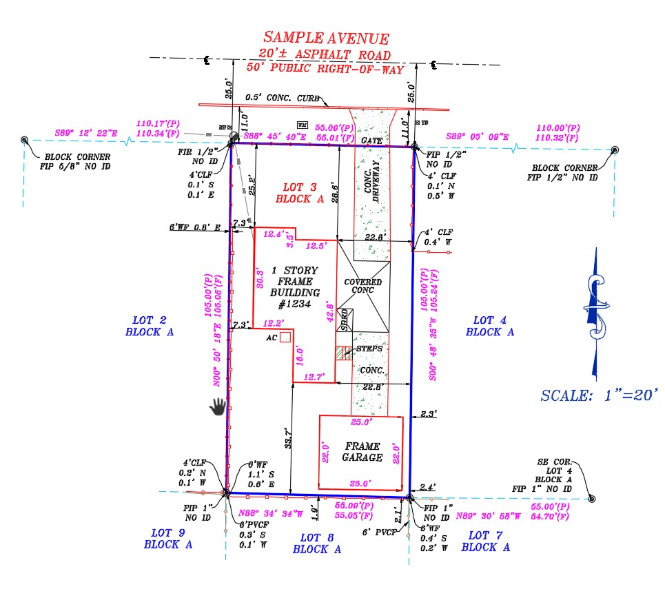
1. Boundary Survey
A boundary survey defines the legal limits of a property. We convert deed research, recorded plats, and field monumentation into legally sound boundary drawings.
Learn More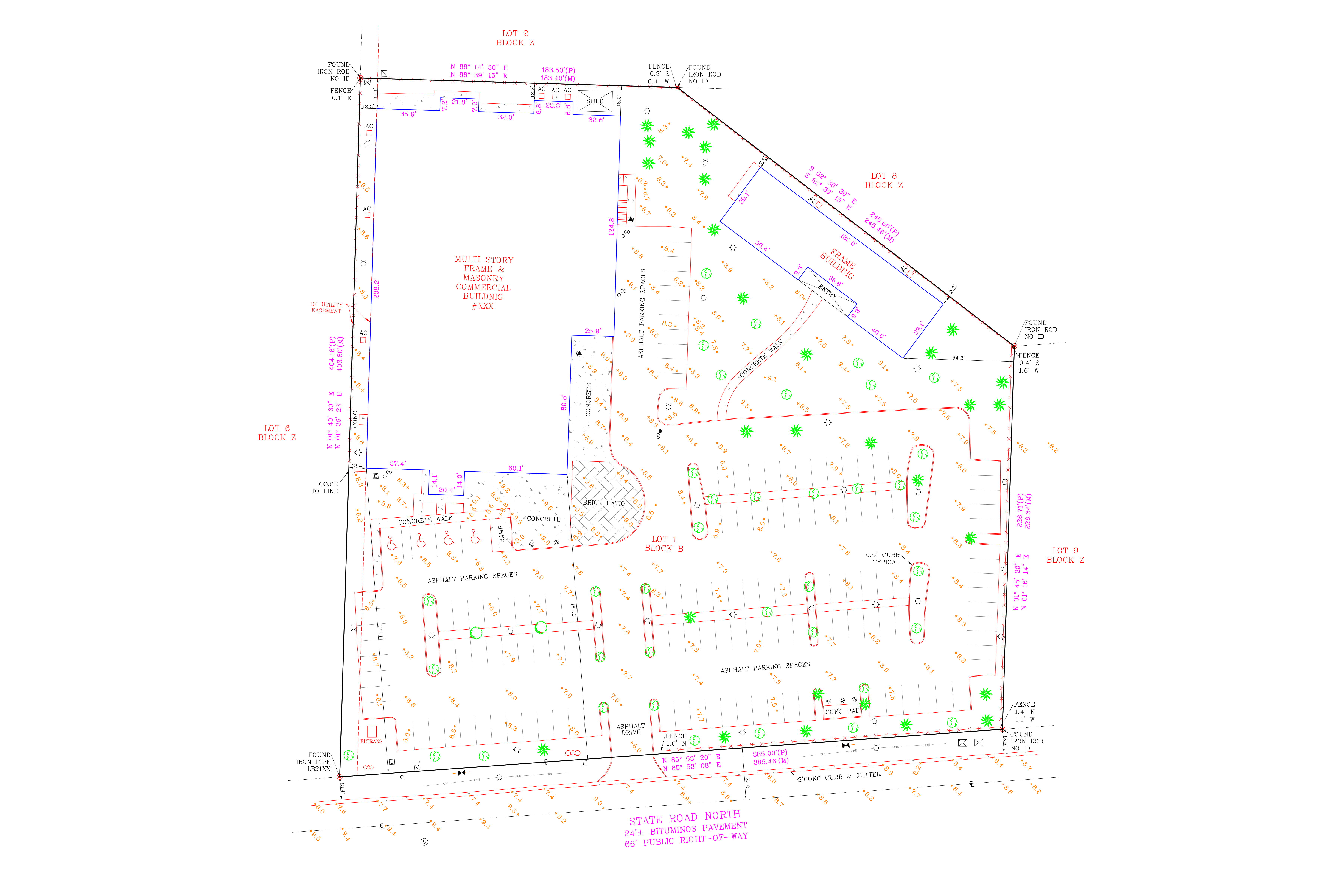
2. Topographic Survey
We turn elevation shots, breaklines, and surface data into topographic drawings your engineering team can design from immediately.
Learn More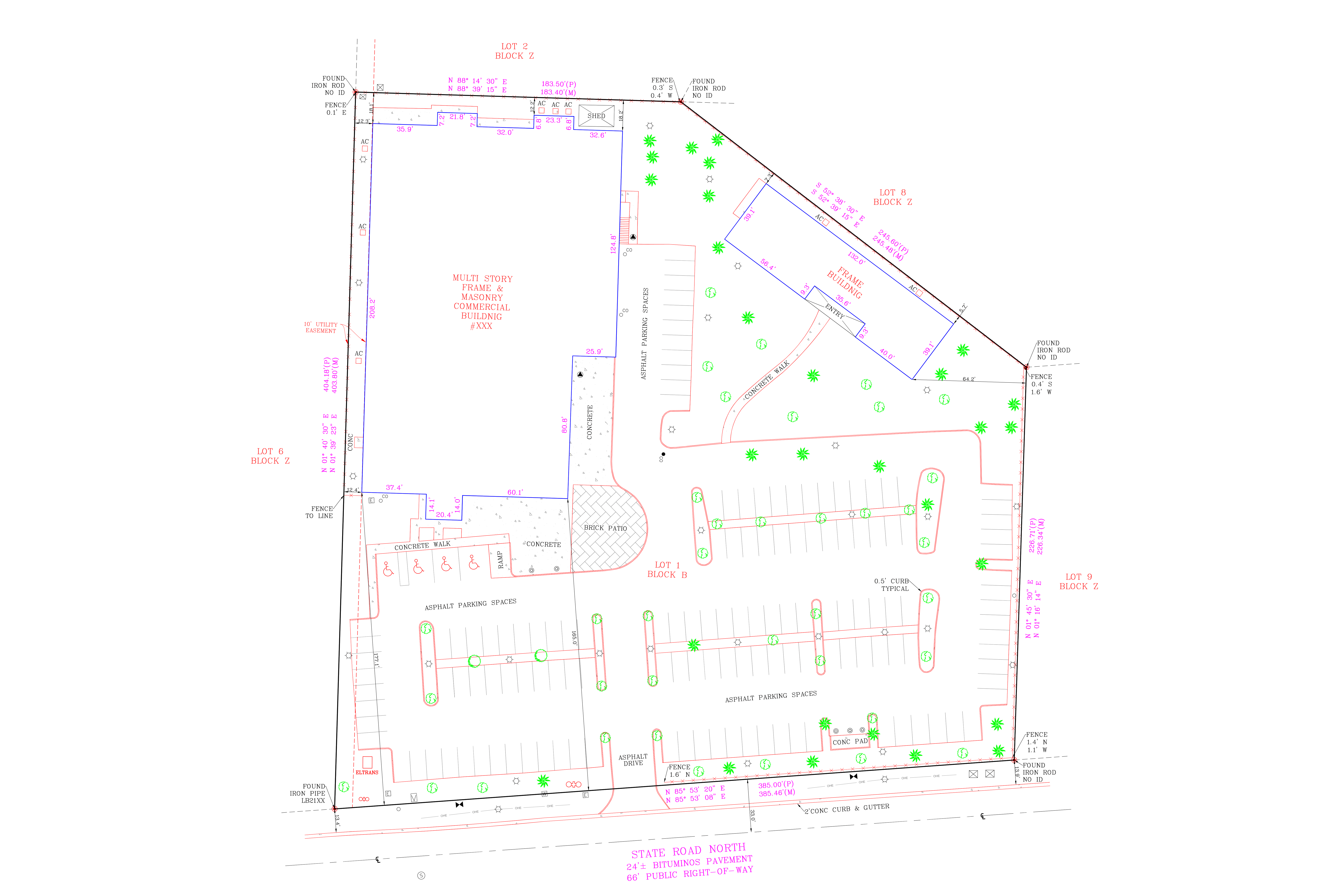
3. ALTA Survey
Built to current ALTA/NSPS standards, incorporating flood zone data, setbacks, and Table A optional items.
Learn More4. Residential Mortgage Survey
Clear, lender-ready drawings produced quickly to keep pace with closing deadlines without sacrificing accuracy.
Learn More5. House Location Survey
No-frills zoning and setback compliance drawings for permitting, additions, or improvements.
Learn More6. Tree Location Survey
Precision mapping of trunk diameters, species, and canopy spreads to satisfy local tree preservation ordinances.
Learn More7. As-Built Survey
Documents constructed site improvements (utilities, structures, pavement) compared to original designs.
Learn More8. Subdivision Plat
Drafted methodically from geometry through blocks, matching local requirements for recording.
Learn MoreLand Development
We help firms carry projects from raw parcel to shovel-ready site. Our team is built to absorb fast revision cycles driven by agency comments, client changes, and engineering design updates.
1. Subdivision Layout Plan
Lay out individual lots, blocks, road alignments, and easements compliant with zoning and subdivision codes.
Learn More2. Grading & Drainage Plan
Communicating finished grade contours, spot elevations, and slope details for the construction crew.
Learn More3. Utility Plan
Proposed water, sewer, storm, and dry utility infrastructure layouts clearly formatted for field crews.
Learn More4. Erosion & Sediment Control Plan
Erosion control measures (silt fencing, stabilized entrances) matching the governing municipal BMPs.
Learn More5. Site Plan (Preliminary & Final)
Feasibility preliminary site plans and final permit-ready drawings coordinating footprints and parking.
Learn More6. Road & Street Improvement Plan
Horizontal/vertical road alignments, profile sheets showing grades, curves, lane widths, and intersections.
Learn MorePiping Network Design
ArcusCAD prepares complete piping network drawings for water, sewer, and storm systems, coordinated closely with site grading, utility, and civil design.
1. Water Distribution Network
Plotting water mains, laterals, valves, hydrants, tie-in details, and backflow prevention devices.
Learn More2. Sanitary Sewer Collection Network
Gravity sewer mains, manholes, cleanouts, laterals, structures, and precise invert/slope database plotting.
Learn More3. Storm Drainage Piping Network
Storm sewers, catch basins, junction structures, outfall details, and coordinate checks to avoid clashes.
Learn More4. Fire Line & Hydrant Layout
Dedicated fire service line routing, hydrant spacing compliance, post indicator valves, and Siamese connections.
Learn More5. Pipe Plan & Profile Drawings
Detailed plan and profile sheets showing slopes, depths, crossings clearances, and rim/invert elevations.
Learn More6. Utility Coordination & Clash Review
We overlay networks to detect crossing/clearance conflicts on paper before they ever reach construction crews.
Learn MoreArchitectural Drafting Services
We support architects, home builders, and design-build teams with construction documents built for permitting and the field.
1. Schematic & Concept Drawings
Floor plans and massing studies from concept sketches or design notes, ready for preliminary client reviews.
Learn More2. Construction Document (CD) Sets
Plans, roof layouts, sections, schedules, notes, and details coordinated with structural/MEP sheets.
Learn More3. Permit Set Preparation
Building codes checking, zoning setback evaluations, accessibility reports, and fast plan check responses.
Learn More4. As-Built & Redline-to-CAD Conversion
Converting paper drawings, scanned TIFFs, and redlines into standardized, clean DWG formats.
Learn More5. CAD to BIM / Revit Modeling
Converting 2D assets into smart 3D Revit models, building custom families, templates, and layouts.
Learn More6. Renovation & Addition Drafting
Specialized remodel drafting integrating existing field measures with new structural additions.
Learn MoreMechanical Object Design
ArcusCAD provides high-precision component modeling, fabrication shop drawings, tolerance detailing, reverse engineering, and legacy archive digitization.
1. 3D CAD Modeling
Parametric part models, assembly layouts, and functional meshes built from concept sketches or physical shapes.
Learn More2. 2D Fabrication & Shop Drawings
Detailed views, cuts, callouts, and materials for machined, cast, or sheet metal parts ready for shop floors.
Learn More3. Assembly Drawings & Bill of Materials (BOM)
Exploded and isometric assembly views paired with accurate material counts and part schedules.
Learn More4. GD&T Detailing
Applying Geometric Dimensioning and Tolerancing to ASME Y14.5 rules for perfect stack clearance.
Learn More5. Reverse Engineering
Digitizing physically measured mechanical parts into editable 3D and 2D CAD formats.
Learn More6. CAD Conversion & Legacy Drawing Digitization
Converting old paper archives, microfilms, or scans into clean, standardized CAD components.
Learn More